Data Sets (7)
|
1 of 1
Prev
|
Next
|
Global Human Modification of Terrestrial Systems, v1 (2016)Land Use and Land Cover
To provide a cumulative measure of human modification of terrestrial lands based on modeling the physical extents of 13 anthropogenic stressors and their estimated impacts using spatially-explicit global data sets. |
Global Development Potential Indices, v1 (2016)Land Use and Land Cover
To provide spatially-explicit data that relatively rank global land suitability referred to as Development Potential Indices (DPIs) for 13 sectors related to renewable energy, fossil fuels, mining and agriculture as an aid to conservation priority setting. |
|
Dams, v1.01 (2011)Global Reservoir and Dam (GRanD), v1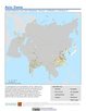
To provide a geographically explicit and reliable database of dams for the scientific community. |
||
Reservoirs, v1.01 (2011)Global Reservoir and Dam (GRanD), v1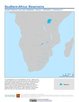
To provide a geographically explicit and reliable database of reservoirs for the scientific community. |
Global Subnational Prevalence of Child Malnutrition, v1 (
|
|


|
1 of 1
Prev
|
Next
|